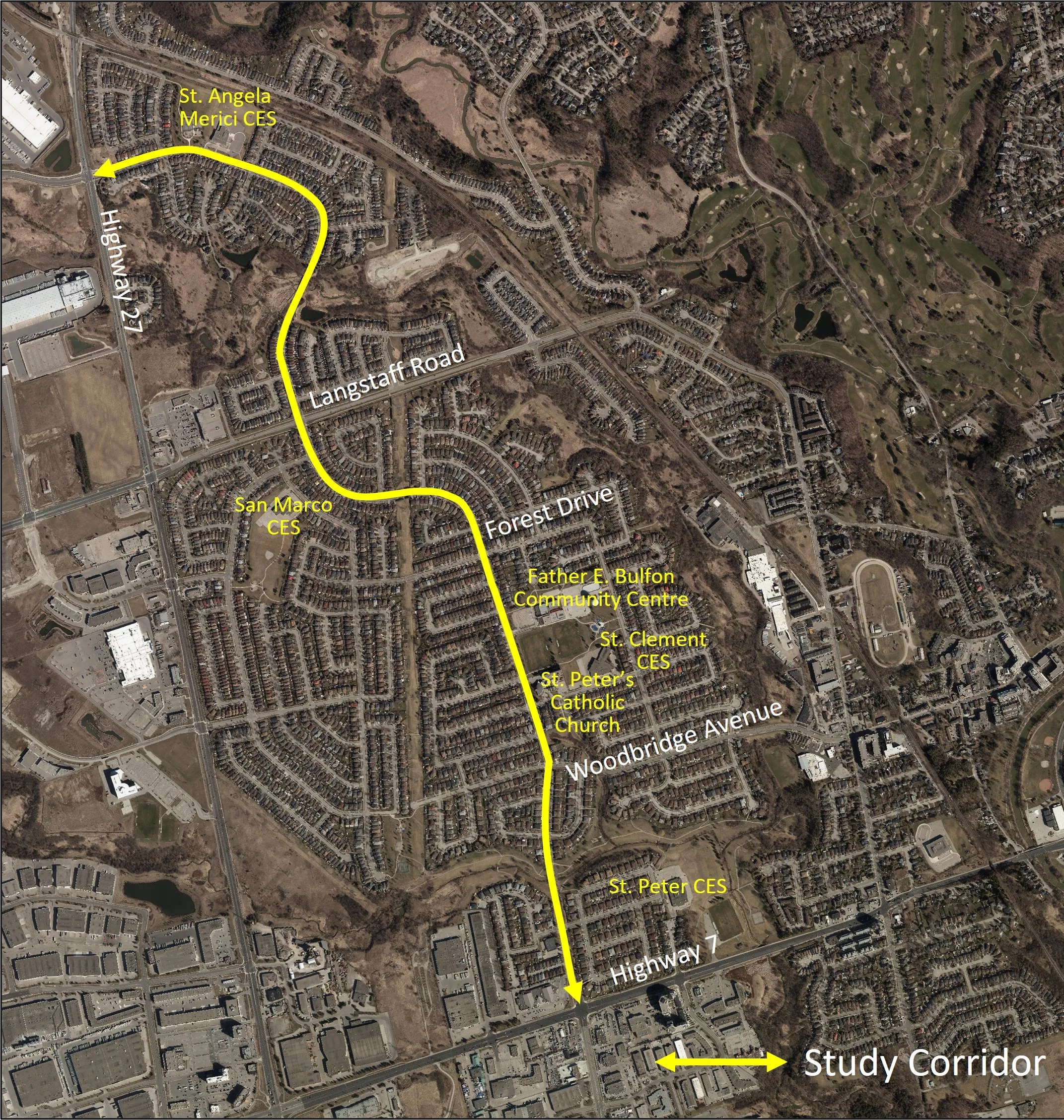
Martin Grove Road
The City is undertaking a traffic study in the Martin Grove area – south of Highway 27 and north of Highway 7.
This area was selected based on our commitment to continue to monitor and address traffic congestion, traffic circulation, truck traffic movements, operating speeds, pedestrian and cycling safety and on-street curbside activity. It was also selected considering the high population of older adults and vulnerable road users.
By assessing traffic operations in the area, the City can identify continued opportunities to address road safety and the overall transportation experience for all users – including those who walk, cycle, roll, take transit or drive on or around Martin Grove Road. In addition to examining vehicle speeds, traffic volumes, site conditions and existing traffic control and calming measures, City staff will work with the community to collect feedback on existing conditions and propose recommendations.
Once complete, this study will enable City staff to develop short- and long-term plans to implement recommendations along Martin Grove Road.
Project timelines
- Launch: April 2024
- Research: April to May 2024
- Phase 1 engagement: June 2024
- Identification of alternatives: June to Sept. 2024
- Phase 2 engagement: Sept./Oct. 2024
- Development of recommendations: Oct. 2024
- Conceptual design: Nov. 2024
- Phase 3 engagement: Jan. 2025
- Report to Council: Spring 2025

Get involved
Read the final report. (PDF)
Phase 3 is now complete
- Open house - Thursday, Jan. 16, 2025, at Father E. Bulfon Community Centre
- Review the Phase 3 display boards. (PDF)
Phase 2 is now complete
- Open house – Tuesday, Sept. 17, 2024, at Father E. Bulfon Community Centre
- Online Survey – Sept. 3 to Oct. 1, 2024
- Read the engagement summary. (PDF)
Phase 1 now complete
- Virtual information session - March 21, 2024
- Watch the recording or view the presentation slides (PDF)
- Online survey - March 1 to March 31, 2024
- Interactive map - March 1 to March 31, 2024
- Read the engagement summary (PDF)
Map of study area

