Lawford Area Traffic Study
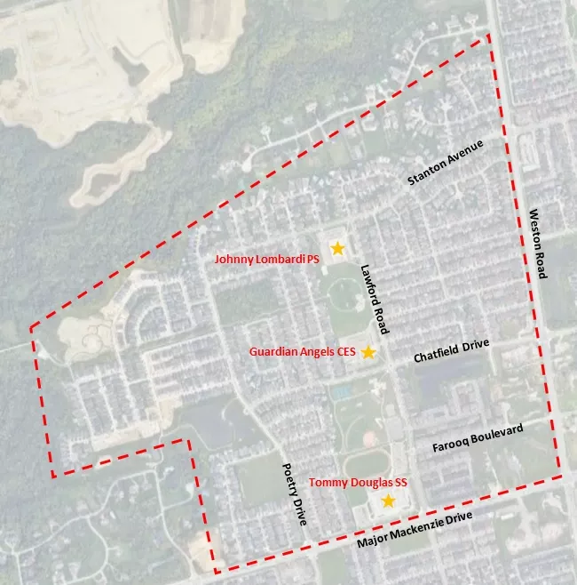
The City of Vaughan has conducted a traffic study for Lawford Road and the surrounding area (north of Major Mackenzie Drive, west of Weston Road, south of Teston Road and east of Pine Valley Drive).
About the study
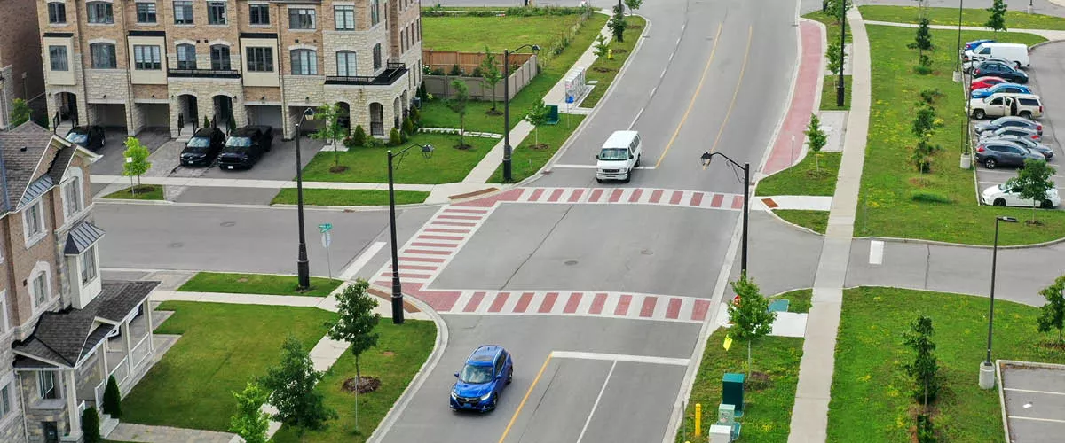
This study was undertaken in response to concerns raised by the community regarding speeding, road safety and traffic volume. It assessed traffic operations within the Lawford Road area, which includes Stanton Road, Chatfield Drive and Poetry Drive, and connecting local roads. Read the final report (PDF).
Background
Residents have raised concerns about high traffic volume and speeding on Lawford Road, Sedgewick Place and the surrounding road network. In 2022, staff completed traffic operational reviews to investigate and address these concerns.
As a result, the following speed management measures were installed:
- radar message boards as part of the City’s Speed Compliance Program
- a “pedestrian ahead” warning sign on Sedgewick Place
- larger stop signs at Chatfield Drive and Sedgewick Place
- an all-way stop at the intersection of Lawford Road and Harley Drive in 2021 and Lawford Road and Farooq Boulevard in 2022 to control the right-of-way at the intersection
On Sept. 28, 2022, Council approved the Sedgewick Place and Neighbourhood Area Traffic Review (PDF) staff report and directed City staff to advance the development of the neighbourhood traffic plan and include community consultations in the study process.
After completing a preliminary assessment, the study area was expanded to cover Lawford Road and the surrounding road network (north of Major Mackenzie Drive, west of Weston Road, south of Teston Road and east of Pine Valley Drive).
Three schools are located along Lawford Road: Guardian Angels Catholic Elementary School, Johnny Lombardi Public Elementary School and Tommy Douglas Secondary School. Guardian Angels Catholic Elementary School and Johnny Lombardi Public Elementary School are part of the City’s Active School Travel pilot program. As part of this program, the following speed management measures were implemented along Lawford Road near Guardian Angels Catholic Elementary School and Johnny Lombardi Public Elementary School:
- flexi post signs and bollards (seasonal; removed during winter for the City’s snow-removal operations)
- radar message boards
- center lines and edge lines on Stanton Avenue and Lawford Road
- “slow school zone” pavement markings on Lawford Road
- wayfinding signage
Previous engagement opportunities
Open House (April 18, 2024)
The project team hosted an open house at Tommy Douglas Secondary School (4020 Major Mackenzie Dr.) to share the findings of the Lawford Area Traffic Study (PDF).
Open house (Sept. 19, 2023)
The project team hosted an open house at Tommy Douglas Secondary School (4020 Major Mackenzie Dr.). Review the presentation slides (PDF).
Email comments (Sept. 19, 2023)
Residents were invited to share feedback on the proposed design solutions by emailing lawfordstudy@cima.ca.
Virtual information session (June 15, 2023)
If you were unable to attend the virtual information session, you can review the presentation slides (PDF).
Online survey (June 1 to 21, 2023)
Online mapping tool (June 1 to 21, 2023)