About Weston 7 Transportation Master Plan
About Transportation Master Plan
Concurrent with the Weston 7 Secondary Plan, the Weston 7 Transportation Master Plan is being carried out in accordance with Phases 1 and 2 of the Municipal Class Environmental Assessment. Once complete, it will recommend a transportation plan including a multi-modal transportation network that addresses connectivity, accessibility and mobility for all modes of transportation. The finalized plan will be available for public review and information.
Weston 7 Transportation Master Plan Study area
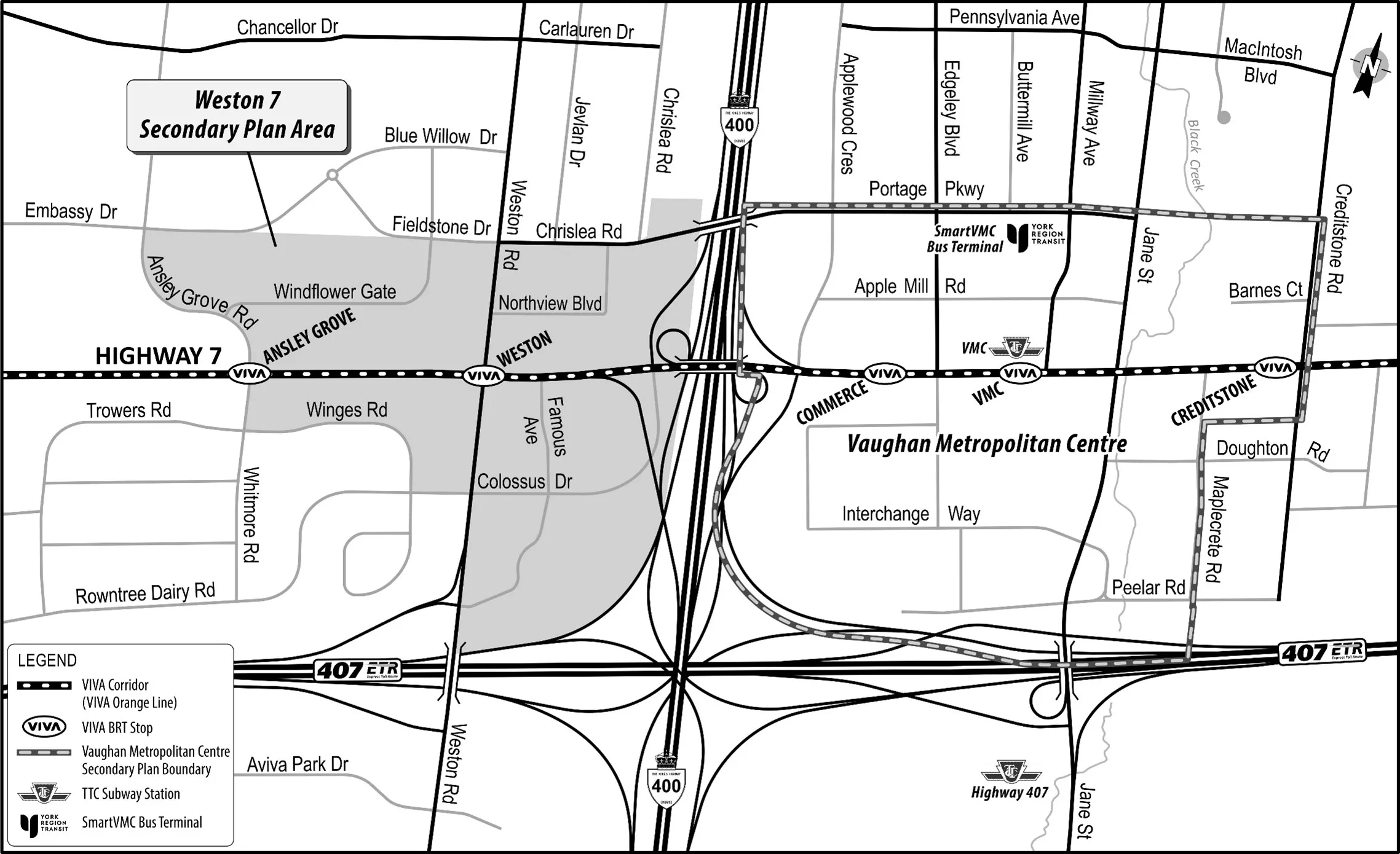
The Weston 7 corridor is bounded by Fieldstone Drive, Chrislea Road and Portage Parkway to the north; the Highway 400 corridor to the east; the Highway 407 corridor, Rowntree Dairy Road, and Trowers Road to the south; and Ansley Grove Road and Whitmore Road to the west.
About the study
The Weston 7 Transportation Master Plan commenced in November 2020 and has two phases:
- Phase 1: Problems and Opportunities (transportation needs assessment). In this phase, the City identifies the transportation infrastructure needs to support the planned growth within the Weston 7 area. This is then summarized in a Problem and Opportunity Statement.
- Phase 2 (early): Identify and Assess Transportation Solution Alternatives. Early in phase 2, the City develops and assesses the multi-modal transportation network options for the movement of goods and people. This includes roads, sidewalks, cycling routes, transit and more.
- Phase 2 (end): Selection of the Preferred Transportation Plan: The study outcome will include recommendations for a multi-modal network that best integrates with, and meets the needs of, the Weston 7 area.
If you have any questions or wish to be added to the mailing list for the Weston 7 Transportation Master Plan, please email Weston7TMP@wsp.com.