Kipling Avenue and Highway 7 Study
Northeast Quadrant of Kipling Avenue and Highway 7 Land Use Study
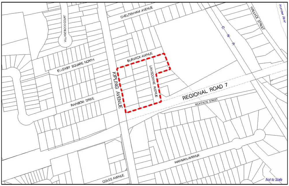
The City has initiated the Kipling Avenue and Highway 7 Study for the northeast quadrant of the Highway 7 and Kipling Avenue intersection. The study area is approximately 2.42 hectares, bounded by Highway 7 to the south, Kipling Avenue to the west, Burwick Avenue to the north, and the property boundary of the existing Woodbridge Public Elementary School to the east, as shown on the study area map below.
On December 9, 2014 Vaughan Council directed that this land use study be undertaken to examine whether changes to the current Official Plan policies governing the use and development of the subject lands is warranted given the recent development approvals in the immediate area. The purpose of the study is to consider appropriate land uses and development criteria, such as the permitted density and building heights and the urban design objectives for the area. This process may form the basis for an amendment to the Official Plan to implement the findings of the study.
Northeast Quadrant of Kipling Avenue and Highway 7 Area Specific Plan - Council approved on December 11, 2017
Public Consultation
Notice of Adoption for Amendment # 20 to the Vaughan Official Plan 2010
Committee of the Whole (Public Hearing)
Date: Tuesday, October 3, 2017
Location: Vaughan City Hall - Council Chamber
-
Proposed Northeast Quadrant of Kipling Avenue and Highway 7 Area Specific Plan (August 29, 2017)
-
Northeast Quadrant of Kipling Avenue and Highway 7 Land Use Planning Study Report (August 29, 2017)
Public Open House Meeting #2 – June 7, 2017
Public Open House Meeting #1 – May 5, 2016