Centre Street Urban Design Guidelines + Streetscape Plan
Purpose:
The purpose of the Centre Street Urban Design Streetscape Plan is to provide design guidance and standards applicable to the public realm and new development along the Centre Street corridor study area.
The study seeks to manage change and coordinate future public realm and private (re)development along the portion of Centre Street within the study area that is identified as a Regional Intensification Corridor in Vaughan's Official Plan, and as a Regional Corridor in the York Region Official Plan. The City of Vaughan's Centre Street Streetscape Concept Plan developed through this study will inform the detailed streetscape design for the Centre Street segment of the VivaNext Rapidway Construction project.
Summary:
Centre Street is already undergoing a transformation from a vehicle-dominated transportation corridor into a pedestrian-friendly environment with adjacent built form and a public realm that supports active transportation, the urban ecosystem, social and commercial activities.
The Urban Design Guidelines set out to give shape to the land use policies for the Centre Street corridor. They help to provide clarity on what the intended development outcome ought to be, tailored to the unique circumstances and opportunities of this destination in the City of Vaughan.
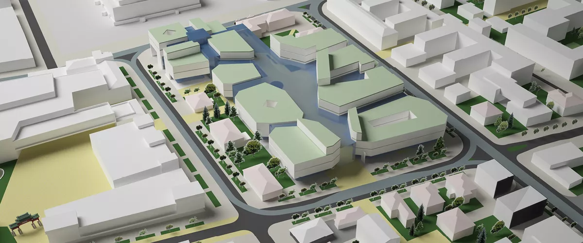
The Streetscape Plan is a response to a detailed analysis of existing conditions and Urban Design Guidelines developed to inform the VivaNext Rapidway streetscape planning for Centre Street and future development along the corridor. It provides a conceptual layout and design of public and private streetscape spaces, pedestrian and bicycle connections, as well as a framework that complements built form strategy for building placement, forms, heights, and massing in relation to the public realm within the study area.
The Centre Street Urban Design Streetscape Plan details the comprehensive planning and urban design principles outlined in the Thornhill Centre Street Study (2004), and supports Vaughan and York Region Official Plan objectives. Additionally, the Centre Street Land Use Study (2013), for the lands on the north side of Centre Street between New Westminster Drive and Concord Road, is a complementary document to this Plan.
Study Area:
The Centre Street Corridor study area is approximately three kilometres in length and extends from Bathurst Street in the east to just past Dufferin Street in the west. The corridor includes lands fronting Centre Street on the north and south sides of the street.
Timeframe:
The study began in April 2010 and the draft plan completed in 2013 in coordination with community consultations and the City of Vaughan Centre Street Land Use Study. Implementation of the project is in coordination with the VivaNext bus rapid transit project and the Vaughan City-Wide Streetscape Implementation Manual and Financial Strategy (2014).
Current Status:
The draft Centre Street Urban Design Streetscape Plan is completed and may be viewed here:
Centre Street Urban Design Guidelines
Centre Street Streetscape Plan:
2. Streetscape Design Strategy
3. Concept Plan (subject to modifications through detailed design and implementation)
Public Consultation:
The Centre Street Urban Design Streetscape Plan consultation process engaged community and stakeholders, including the following key events:
- November 23, 2011 - Public Open House, Dufferin Clark Community Centre
- June 7, 2011 - Public Open House, Dufferin Clark Community Centre
- May 5, 2011 - Public Open House, Dufferin Clark Community Centre
- May 25, 2010 - Public Open House, Patricia Kemp Community Centre
- April, 28, 2010 - Stakeholder Discussion Group, including representatives from the Concord West Ratepayers Association and Brownridge Ratepayers Association, City Hall