Carrville District Centre Urban Design Guidelines + Streetscape Plan
Purpose:
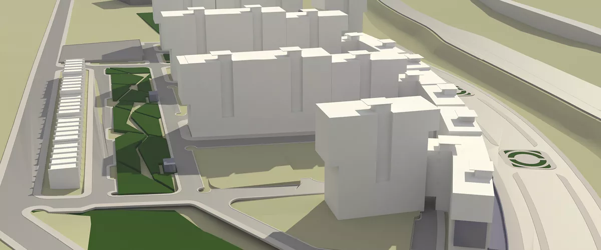
The purpose of the Carrville District Centre Urban Design Streetscape Master Plan Study was to prepare Urban Design Guidelines and Detailed Streetscape Master Plans to guide future development in accordance with the Urban Design policies of the Carrville District Plan OPA 651. This study establishes the layout and detailed design of the public and private streetscape spaces, pedestrian and bicycle connections, public amenities and open spaces, as well as criteria for building locations, forms, heights and massing in relation to the public realm. The final design concept for the community was developed through extensive workshops and meetings with various stakeholders that commenced in the spring of 2008.
Location:
The Carrville District Centre is located in the east portion of the City of Vaughan. The area is comprised of approximately 57.0 hectares and is generally located at the intersection of Rutherford Road and Dufferin Street.
Click here to view the Study Area Map.
Current Status:
The Carrville District Centre Urban Design Streetscape Master Plan Study was approved by Council on June 29, 2010. The Carrville District OPA 651 (Amendment) was adopted by Council on September 7, 2010 and is pending Region of York final approval.
Click below to download a copy of the Carrville District Centre Urban Design Streetscape
Master Plan:
Part 1: Introduction and Context
Part 2: Vision and Community Structure
Part 3: Urban Design Guidelines - District Centre
Part 4: Parks and Open Space System
Part 5: Streetscape Design
Part 6: Sustainability Considerations
Part 7: Implementation and Phasing Considerations
Part 8: Appendices
References:
Carrville District Centre Study (OPA 651)