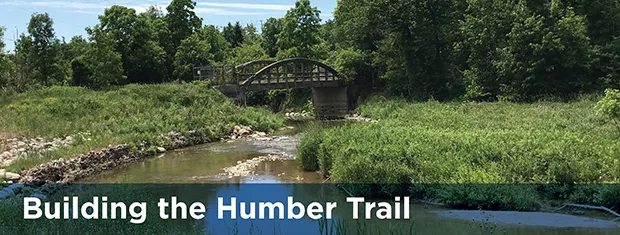
Humber Trail
The City of Vaughan has partnered with the Toronto and Region Conservation Authority (TRCA) to complete a feasibility study to explore ways to expand the Humber Trail and connect a seven-kilometre gap between Boyd Conservation Area and Steeles Avenue West.
From Monday, June 8 to Sunday, July 4, 2021, the City invited the community to provide input on several aspects of the feasibility study, including proposed route options and priority projects. We also asked for your thoughts and ideas on how to encourage more residents to use Vaughan's trails. Thank you for those who participated.
Your feedback was be used to update the feasibility study and prepare a report with recommendations to presented to Vaughan Council in fall 2021. Moving forward to design and construction will be subject to funding for implementation.
The City received funding from the Government of Canada's Active Transportation Fund to design an extended section of the Humber Trail, approximately 1.4 kilometres, along the William Granger Greenway, from the Boyd Conservation Park to Langstaff Road. This funding will go toward detailing this trail route and associated structures, signage studying, trail amenities, landscaping and restoration needs.
The Active Transportation Fund is investing $400 million over five years to expand and enhance active transportation networks across Canada to make travel by active transportation easier, safer, more convenient and more enjoyable, in support of Canada's National Active Transportation Strategy. More information about the funding is available in this news release.
Funding provided in part by the Government of Canada.

-
Answer
About the Humber Trail
The Humber Trail Feasibility Study started in May 2018 and explores potential routes for the new trail. The study aims to identify options that balance the current and future recreational and transportation needs of residents with the ecological functions of the natural heritage system of the Humber River Valley, ensuring the protection and enhancement of environmental features and functions.
The Humber Trail forms part of and further advances the Vaughan Super Trail, a bold initiative to create a world-class, identifiable trail that links communities and connects people with nature, cultural heritage, communities and special destinations throughout the city of Vaughan. The Humber Trail also forms part of the TRCA Trail Strategy Greater Toronto Region Trail Network. The Trail Strategy outlines TRCA’s plan to work with partners to complete, expand, manage and celebrate the Greater Toronto Region Trail Network, a connected trail network in our regional greenspace system. It serves as a framework to protect potential trail alignments, and to guide the planning, development and management of these trails. TRCA’s progress on implementing the Trail Strategy can be found on the TRCA Trail Strategy Dashboard.
Image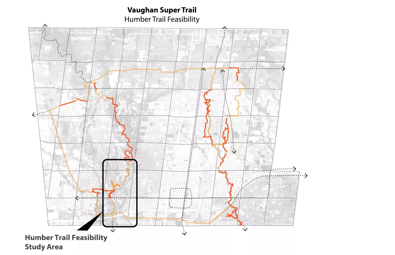
View a larger version of this map (PDF).
Background
Following the recommendations of the 2020 Pedestrian and Bicycle Master Plan, the emerging focus is to close gaps along key city-wide trails, including the Humber Trail. The Humber Trail Feasibility Study is one step of the process needed to connect a critical gap in the trail along the existing Humber Trail between Boyd Conservation Area and Steeles Avenue West. This connection will complete a key regional trail that extends northward through the William Granger Greenway to the Nashville Conservation Reserve and southward through the City of Toronto to the Lake Ontario waterfront.
The feasibility study includes a high-level assessment of cultural and natural features present in the Humber valley corridor, areas of environmental sensitivity and opportunities to optimize active transportation to determine trail options of “best fit” and informs the next steps for the project, which include:
- serving as a foundation to further study and evaluate trail alignment options through additional investigations environmental assessments.
- identifying and prioritizing improvements and state-of-good-repair investments in trails and supporting amenities within the identified segments.
- providing guidance in identifying capital planning efforts and capital budget requests
-
Answer
Project Timeline
- Spring 2018 – Kickstart the Humber Trail Feasibility Study
- Fall 2018 – Phase 1: Research, inventory and analysis
- Winter 2019 – Phase 2: Development and evaluation of trail alignment alternatives
- Winter 2020 – Phase 3: Develop draft feasibility plan and report
- Summer 2021 – Phase 4: Solicit public feedback on the draft feasibility study findings. The City will use feedback collected to update the feasibility study and prepare a report with recommendations to be presented to Vaughan Council.
- Fall 2021 – Phase 5: Finalize feasibility study and recommendations report
The City of Vaughan recognizes the value multi-use recreational trails bring to citizens as demonstrated by community engagement and the feedback received through the 2020 Pedestrian and Bicycle Master Plan, the 2018 Active Together Master Plan and the TRCA Trail Strategy for the Greater Toronto Region.
Study Material
The feasibility study has divided the study area into five component segments. Major arterial roads mark the division between the five study segments, which are organized from north to south as follows:
- Segment One – Pine Grove Road to Boyd Conservation Area (PDF)
- Segment Two – Thistlewood Avenue to Pine Grove Road (PDF)
- Segment Three – Highway 7 to Thistlewood Avenue (PDF)
- Segment Four – Highway 407 to Highway 7 (PDF)
- Segment Five – Steeles Avenue West to Highway 407 (PDF)
Review a map of route options and segments (PDF).
Review the short-term potential priority areas (PDF).
Final report:
Vaughan Humber Trail Feasibility Report (PDF)
Appendix A - Photo location Maps and Photos (PDF)
Appendix B - Background Maps (PDF) - Available upon request
Appendix C - Vaughan Bowstring Bridge 2018 Report (PDF)
Appendix D - Data Layers (PDF)
Appendix E - Bowstring Bridge Site Hydraulic Investigation Reports (PDF)
Appendix F - Natural Heritage Report (PDF)
Moving forward to detailed design and construction will be subject to securing funding for implementation.
Contact Information
Michael Habib,
Parks Open Space Planning
Parks Infrastructure Planning and Development
email: michael.habib@vaughan.ca